Ads 468x60px

  • First Lesson

    7/31/2010 was my first lesson. This is when i embarked on my new found love and hobby. I began to fly regularly after that first flight. I have found a new passion that was a childhood passion of mine!

  • Solo Time

    July 4th 2011 was my first solo. I flew at Oxnard Airport. All three landings were awesome, and increased my confidence more than i could ever explain. The first solo will stick with me for the rest of my life!!! It was a turning point in my hobby!

  • Still Learning, Striving, and Flying

    It has been a long journey, and an expensive on as well. But i stuck to it and keep flying as i am now so fascinated by it. I strive to learn more, and now i understand a pilots license is a license to learn!

Saturday, September 24, 2011

Long Cross Country Solo 154NM


This past weekend I did my Long XCountry Solo.  It was a wonderful experience, and shows me, that I can be pilot in command and navigate just about anywhere I want with little to no problem.  It shows me that on the fly I can come up with other plans of action, and be able to find information quickly and accurately. 

The morning of my flight, I was planned to go from KVNY, and fly to the FIM VOR, then to the RZS VOR.  This would bring me right by Santa Ynez.  Then I would fly off the RZS VOR and once at Santa Maria, would turn north and head to the Paso Roblos (KPRB) airport to land.  Then I would take back off, and go back to Santa Maria, and land for lunch.  Then I would take back off and fly back to RZS -> FIM -> KVNY.  Pretty simple and normal flight plan I had for the trip.

There was still some overcast/fog on the route, since it was near the coast.  KIZA was forecasting overcast until noon.  And my flight was at 10:30.  I needed to be back by 4 and my flight was planned to take 1 ½ hour each way with a lunch in there somewhere.  So leaving at noon was not going to cut it.

Upon talking with mike for my briefing, he had something completely different in mind, but it worked out for the best, because it allowed me to leave for the destination and miss the overcast marine layer completely.  He wanted me to go towards Bakersfield and then fly north, then track over west to KPRB, then go to KSMX, and then back to KVNY.  This would take me over the desert, which was clear now, and leave more time for the marine layer to dissipate while I was on my way to Paso Roblos.  He said to follow the 5 freeway to the grapevine to get over to Bakersfield, and told me I would need to be at 8,500 to clear the mountains there. 

I quickly got to work to get a new flight plan in order.  My new proposed route would take me from KVNY, to VPLMM (Magic Mountain).  Then I would follow the 5 freeway over to the Gorman VOR, then would track from the Gorman VOR to L17 (Taft-Kern Co), then to the AVE VOR, then I would track west to KPRB.  This route looks good and promising. 

I get all the calculations together and show it to mike.  He likes it.  He suggested I take this route there, and then use my other flight plan for the return route, just reserve it.  The new route was 154 NM and had landing at a controlled and uncontrolled airport.  It had 3 landings total, and with one of the legs greater than 50 miles as well.  This would definitely qualify as the long xcountry trip for the PPL requirements.

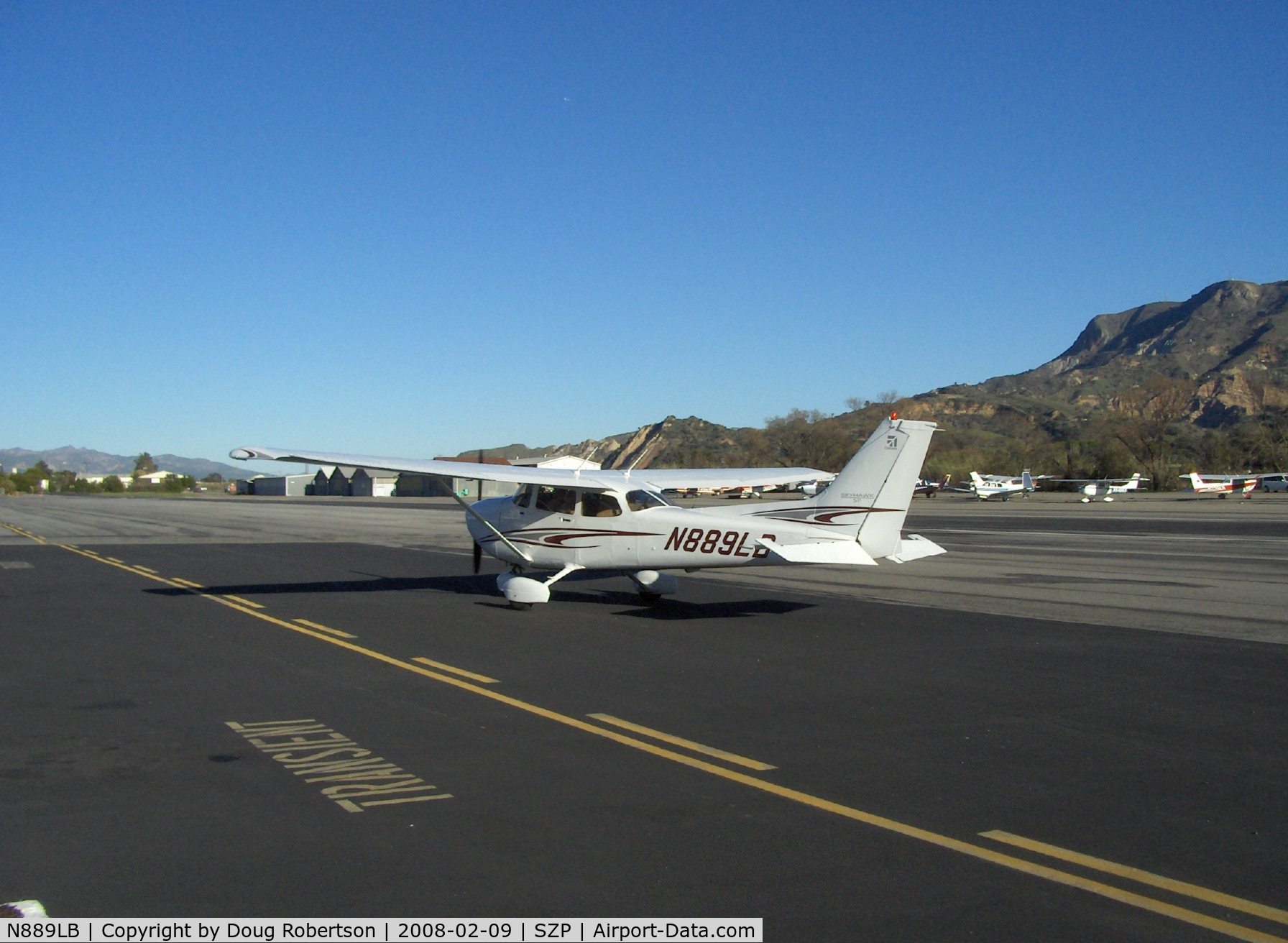
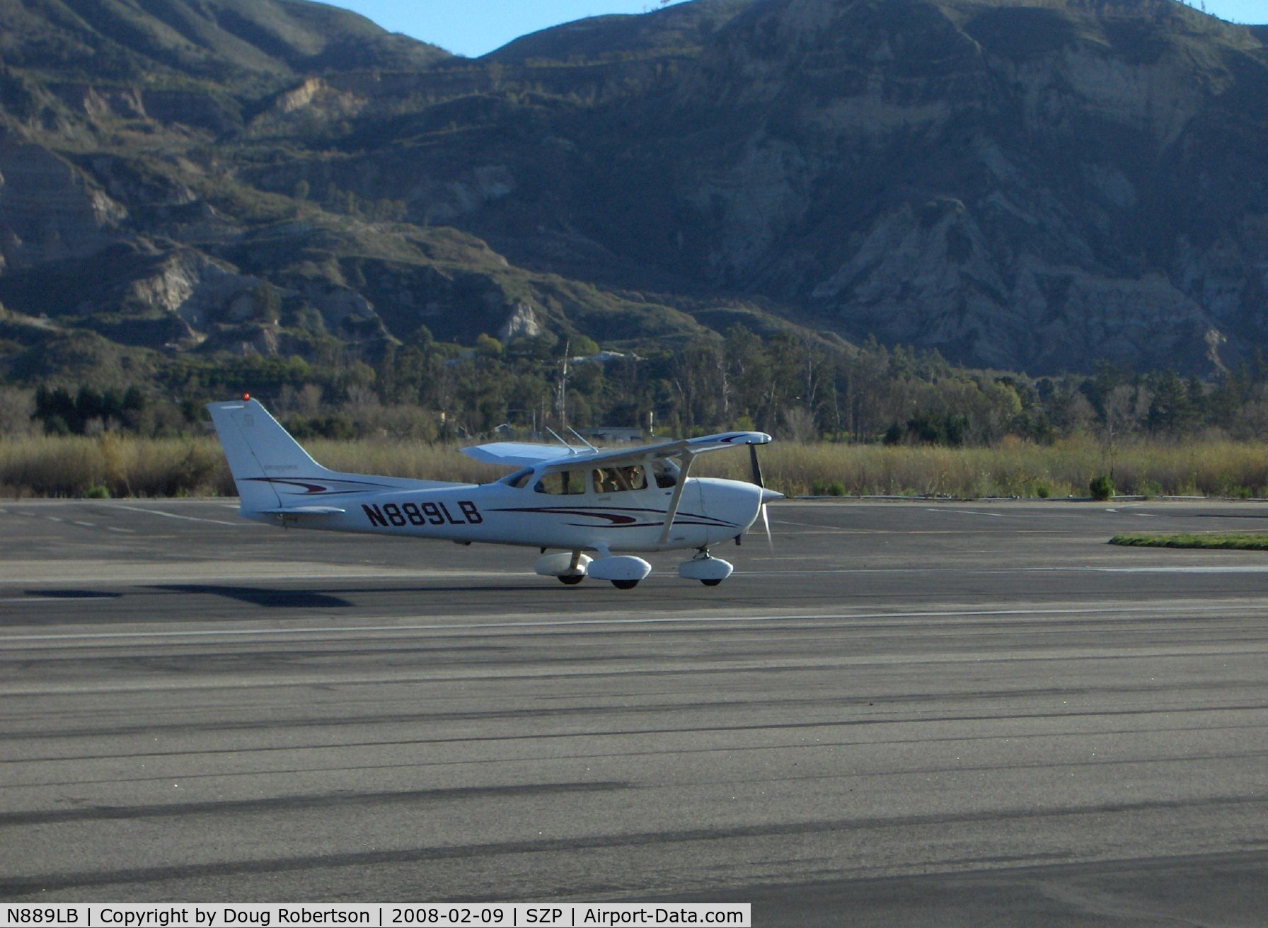
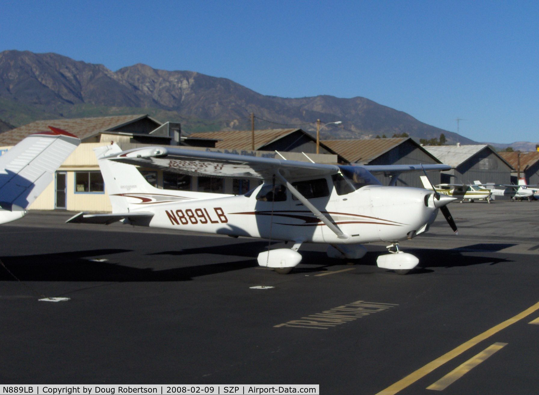
Shortly after I get handed the keys and start my preflight inspection.  Half way through, mike comes over, we talk for a few minutes, then he tells me to text him at each airport, and when I get back to KVNY, and to call him if I have any questions or issues.  He is now gone, and it’s just me, KVNY, and N889LB.  During the preflight, we only had 6 quarts of oil, and since this was going to be a long xcountry, I added a quart just to be on the safe side.  The plane looked good other than that.  I get in and get situated. 

I purchase a little GoPro type camera so I can film my landings.  Only problem is, I mounted it pointed to high up, so in the video you see the top of the propeller, and that’s it.  All of the video is like that too.  None of it is useful, and you never really see the ground in the video.  Even on the landings.  So I had to scrap the video, and use the pics that I took.  Next trip, I will definitely have it mounted correctly so you can see what I see.  Not just blue sky the entire time.

I get cleared for takeoff for a right downwind departure.  I get up in the air, and get on the downwind.  Mind you I need to stay below 2,500 until out of Burbank airspace.  Then I initiate a climb to get up to 8,500 before I get to the mountains.  It takes about 15 minutes to get up to 8,500’.  As I climb, I contact SoCal Approach and request flight following to KPRB.  Write down squawk frequencies, change altimeter, and many other things while im climbing.  The trim makes this easy.  Trim for 74 knot climb speed, and frequently glance at the airspeed, and vertical speed indicator, along with OUTSIDE.  ALWAYS LOOK OUTSIDE!!!  This will make it to where you can do other things you need to do, while still in a climb.

Almost to pyramid lake, I get a call from Bakersfield Approach, “Skyhawk 9er lima bravo, are you familiar with the TFR over Gorman currently?”  CRAP.  I forgot to call for a weather briefing on the new route before I left.  CRAP!  Now I feel like a moron.  I reply, “Uhhh, That’s a negative for 9er lima bravo, was not aware of the TFR”.  They give me the details and were nice enough to vector me around the TFR.  I look on the G1000 and sure enough, there is the TFR.  I almost screwed up.  GOOD THING I WAS ON FLIGHT FOLLOWING!  They not only give you traffic advisories, they saved me from getting a F16 off my wing.  I have to track a bit east to stay out of it, but no problem.  Once past I get told to resume own navigation.

So lesson learned there.  ALWAYS CALL FOR UPDATED ROUTE BRIEFING.  Also, Flight Following is a savior.  I love flying with flight following.  They have multiple times helped me out as a student pilot, with my cross country trips.  The also help to clear you through airspace you would normally need to avoid.  They give updated altimeter settings.  I think I will always use flight following when in route.

I fly to L17 in no time, using landmarks as references and marking my location on the map.  On my way I did a little test situation, where I was lost and did not know where I was.  So I used the AVE VOR along with the EHF VOR to find out where it was.  I tuned in each VOR, and then moved the OBS knob until I got a reading of from with a centered needle.  Then I would note the course and draw that on my map.  Then I did the same thing with the other VOR.  Within a minute, I can tell that I am roughly on the 196 degree outbound from EHF and the 116 degree outbound from AVE, or at the “TAFTO” intersection.  That would put me about 6 miles east of L17. 

While flying before I used the VOR’s to find my location, I leaned the engine to 100 degree ROP (Rich of Peak).  It took me 3 minutes to get it just right, as I have been reading TONS of articles on leaning the engine and engine ops in general.  I didn’t want to hurt the engine, so I feel 100 ROP is a good number to properly cool the engine, give it the needed power just in case, and prevent detonation.  I fly the G1000 NAV iii with EGT and CHT for each cylinder.  Although the manufacturer recommends 50 LOP (Lean of Peak), I feel uncomfortable going LOP as you lose a little power, and it just doesn’t have the “umph” it should.  I would rather run a little rich as well, just in case I descent and forget to set the mixture right away, I don’t want the engine to quit because of the lack of fuel to air ratio.  It cost a little more fuel, but you gain additional power, and airspeed from the richer mixture rather than LOP. Back to the flight.

I then get handed off to LA Center.  I switch over and make the radio call to check in, and wait with no reply.  I wait about 2 or 3 minutes, and then I make another call.  “LA Center, Skyhawk 889er lima bravo, with you, 8 thousand 5 hundred”.  Then I wait 2 or 3 minutes with no reply again.  I then switch back to Bakersfield to verify I have the correct frequency which they verify that I do.  I switch back over, and wait 2 or 3 minutes, then make another call.  Then I hear some faint, static.  I wait another minute, and I hear the crackle of someone saying “lima bravo, how are you hearing this transmission?”  I wait a second to make sure it’s for me and no one else, then reply “889er lima bravo, can hear you now, load and clear”.  Maybe I was in a bad reception spot, or maybe the radios were weird in that area.  But I guess they heard me, I just couldn’t hear them.  They advise me they have radar contact and give me the altimeter setting.  I continue to fly towards AVE VOR. 

Once at AVE, I already have the ASOS for KPRB loaded, and have the current conditions.  Runway 19 is in use.  I turn towards the airport, and start my descent.  I need to lose 6500’ and AVE is 30 miles away from KPRB.  So I start the descent once passing over KPRB.  But I start a shallow descent.  Since I am in no rush I loose altitude.  I set the RPM’s back to about 2200 and start a 300-400 FPM descent.  I descend for about 5-10 minutes.  This gets me to exactly pattern altitude of 1800’ by the time I ready to enter the pattern.  I have already been listening to CTAF and have made multiple calls by this time.  I enter on the 45 for left traffic runway 19.  There were multiple other people in the pattern, yet, I had no trouble getting into the pattern.  I announced my position on entry to 45, on downwind, base, and final.  The landing here was awesome.  Touched right before the 1000’ markers and got off at the 2nd taxiway.  I flew in the ground effect for a little before touchdown, and I was a little flat on touchdown, but all in all I will take that as a good, nice, controlled landing.

I taxied back to the active runway 19.  Held short for landing traffic, then announce I’m taking position on the runway, and then depart the runway for a straight out departure.   I climb up to 5500’ as the trip over to KSMX was not that far.  It is only 47 miles from KPSB to KSMX.  I chose the altitude as there is a wilderness area that I need to stay 2000’ above and the altitude of that is 3000’.  I start to descent when L52 was directly off of my right wing, roughly 15 miles.  I needed to lose 4000’ so this seems correct.  I contact KSMX 10 miles out and announce I’m inbound for landing.  They tell me to advise them when abeam the tower, and to enter right traffic, runway 30. 

There was no one else at the airport.  They were quiet, and no aircraft in the pattern.  I entered on the 45 on the downwind leg.  Advised tower when I was abeam, and I was cleared to land runway 30.  I flew a normal pattern, yet the landing was a little wonky.  When I landed, it felt like I was bouncing up and down, rapidly, but only an inch or two off the ground.  I’m not sure if this was the landing, or maybe the runway surface had a few bumps in it, but it caught me off guard.  I do know, I did come in a little steep on this landing, as I had about a 600 FPM descent rate, and had to pull back a little more than normal when flaring to suppress the sink rate.  Maybe I did bounce a little a few times while trying to put her down.  After the first or second, I started trying to pull back more to prevent the nose wheel from being part of the bounce, but it seemed the elevators did not do anything, as I was already slowed down, and the nose wheel was already on the ground.  I taxied off the runway to transient parking, shut her down, and we to get something to eat as I was hungry and my stomach was yelling at me. 

The restaurant at KSMX is pretty good.  You need to leave the airport via a gate by the terminal, and then walk into the terminal to get to the restaurant.  There is no way to get to it from inside the airport.  You cannot walk past a certain point.  There is no pedestrian access past the gate to get out of the airport.  I got 3 tacos, and some soup.  The soup was really good and the tacos were decent.  Nothing fancy, but I give it 3 out of 5 stars.  Once I was done, I needed to get back into the airport.  Luckily there were 2 airport police officers in the restaurant.  I advised my waitress I needed to get back into the airport and she informed the police officers.  They escorted me into the airport, then back to the plane.  I checked fuel, just to monitor how much fuel I had vs. what I had planned for the trip.  I did a walk around of the plane, and checked the oil. 

Got her started up and back into the air.  I asked for a right downwind departure, but they approved me for a left downwind departure.  Ok.  I was ok with that, as that kept me out of other people’s way.   I then returned to my normal flight plan, and navigated via VOR’s to come back to KVNY.  On the way there was a layer of smoke from the fire at Agua Dulce that was sitting about the altitude I was at.  It then filled the cabin and the smell of fire/smoke/burning was soon very strong.  It also cut down on the visibility.  I was started to wonder if KVNY would be ok to land at.  I turned in the ATIS once I was able to, and got the weather.  They still had good visibility and were still VFR.  As I was flying I see an aircraft pass in front of me, probably 500’ in front and a hundred feet below me, and it happened out of nowhere after I had become somewhat complacent.   Just after that, SoCal approach chimes in and lets me know about the traffic.  I could hear some alarm or beeping going off in the background, which is probably the alarm for aircraft that have a separation conflict.  I reply and let them know I see the traffic.  I wish I would have had more notice though, although I know those guys are busy and FF is a Load Permitting service by ATC. 

It took me a little get back into Van Nuys, but I landed and taxied the plane to Maguire north to its home.  The landing at KVNY was a nice good landing.  Tied her down, got her all locked up, and returned the key to the class room.  Upon returning to my house, I called Mike and we talked about the flight and future plans for flights.  He was happy with the trip, and was happy it was easy for me to handle.  I told him about the radio going out and the plane crossing directly in front of me.  He brought up a good point.  Even though you’re on FF, your still need to look outside the airplane, as it’s your responsibility to see and avoid traffic and other obstacles.  We talked about my next xcountry solo to get me my 10 hours of required solo time.  We then talked about the night xcountry that we are doing this upcoming Friday. 

We are going to KAPV on Friday weather permitting, on a night xcountry.  These will fulfill my night requirements.  Once I do the xcountry to L08 (Borrego Valley), that will fulfill my solo requirements.  Then it’s brushing up on my skills, and then my check ride shortly thereafter. 
More to come soon!

Wednesday, September 14, 2011

Diversions (KEMT, KFUL, KCPM, KTOA, KVNY)

This past weekend, since I could not fly on Saturday because of the thunderstorms, Mike contacted me Sunday morning, and asked if I wanted to fly.  “I would love to” I replied.  So I get dressed, as he woke me up with the phone call, and got all my stuff, and left to go to the airport.  Good thing the airport is only 15 minutes away from my house.  This made it easy to get there quickly so we had enough time in the air.  The sky was a little hazy, but not really any clouds like there was the day before.  It was a little breezy but not much.  A nice temperature considering what occurred the day before.

At the airport, mike tells me we are going be practicing diversions.  He asked for my TAC chart, and started to look over it.  He said he was going to give me a harder course than he gives his other students, mainly because he is confident I can do it, and he wanted to see how I did under pressure.  He didn’t disclose any information to me about the flight, where we were going, planned to go, altitudes, nothing.  He simply said.  We are flying towards bracket (KPOC).  I was a little nervous, but I knew what to do, and what to look for, and thank god I had the Garmin G1000 in front of me for this.  It made it 100% easier than I expected.  Although it was still a little difficult to perform what mike wanted, while staying safe and legal, in the small amount of time I had.

We get airborne, and once outside Burbank, we get put on flight following.   Just then mike says, “Ohh dude.  I don’t feel so well, so land at the next closest airport”.  I look on my TAC just to ensure it was El Monte (KEMT) and yes it was.  I have landed here many times before.  This should be easy.  I use the G1000 to pull up nearest airports.  Cursor on KEMT hit enter, and then BAM! Frequencies are displayed for us.  Along with a lot of other airport information that is needed.  While pulling up the info, I contact SoCal and request to cancel flight following.  They approve and tell me to squawk 1200.  I perform this, then i tune in El Monte tower, and they are non-stop on the radio.  So we have to stay just out of their airspace.  For about 5 minutes, I am flying right on the edge of their airspace.  Finally I get a radio call in.  “El Monte tower, Skyhawk 88 niner lima bravo, 5 to the north, inbound for landing, negative weather”. The controller comes back and gives me all of the weather.  SWEET! I was just expecting an altimeter setting and the wind.  Then they tell us to turn final, and we are cleared to land.  We turn right towards the runway and begin our descent down to the runway.

Half way to the runway, the controller comes on and tells us to turn right base.  I chime in and say “niner lima bravo is on final”.  She then comes back and corrects the announcement for an aircraft ending in 9LT instead of 9LB.  We land and taxi back to the active once we were on the ground.  Awesome landing! A few moments later while taxing, mike tells me where we are going.  So I stop at the hold short bars, and glance back.  No once behind us, and someone turning final 5 miles out.  We have a moment for me to look at the charts and see how we are going to get to Santa Ana (KSNA).   We need to climb to 3500 and maintain to keep out of Fullerton (KFUL), and stay under the class bravo above us.  And we need to be this high, as the route brings up over Disneyland, and the TFR is 2000’ AGL.  We would be well over this.

We get cleared to takeoff and we do.  We begin our climb to get over the hill that is just south of KEMT.  Once we reach our cruising altitude, mike breaks the silence “Dude, my stomach again.  Need to stop at closet airport NOW!”  Ok.  Use the G1000 to find the nearest airport and it is Fullerton.  I check my chart just to verify and sure enough.  I start an immediate descent.  I get the frequencies for Fullerton, and contact them just 2 or 3 miles before entering their airspace.  They clear us to land and give us altimeter setting along with wind, due to my “Negative Weather” comment.  Good for when you need to get down fast and don’t have time to get ATIS, AWOS, ASOS at controlled airports.  We were high when we were cleared to land runway 24, so I had to practically cut the power, and slip it the entire pattern to loose altitude.  We were at 2500, pattern at Fullerton is 1100, and had to lose 1000+ feet in the pattern just to be at pattern altitude.  Then need to lose another 1000’ to land on the runway.  We extended downwind just a bit to help, and we touched right at the numbers on touchdown.  Sweet!  Landing #2 perfect. 

Mike then says we need to go to an uncontrolled airport, and tells me to go west.  I look at the airspace, and its altitudes, and it seems at 4500 as long as we stay out of the class bravo from 5000 up, we could get over Los Alamitos and Long beach airspace with no problem.  So that’s what we do.  As I look at the chart I see only once uncontrolled airport over to the west and that’s Compton (KCPM).  So I know where we are going from here.  Once almost through long beach, mike asks me if I know what airport I’m going to.  I said yes.  He says, well, that’s why I mentioned it’s uncontrolled; to see if you could put 2 and 2 together.  Using any and all information, to draw the bigger picture always helps.  As we get almost out of long beach’s airspace I start my descent, contact the CTAF and announce my intentions. 

I knew what runway to land on because of the other diversions I was performing that day.  Each one so far has been landing on runway 2* except for El Monte which was 19.  Compton has two parallel runways (Weird for uncontrolled but ok).  So we chose 25L as our runway.  A little scary as on the CTAF a few times we just hear, inbound for landing 25.  So we over flew the airport, looked for traffic, turned south west until over the blimp to resolve a traffic advisory, and then turned back to the left pattern for runway 25L.  We entered at the 45 and started the downwind leg.  Announce position on base and final.  Landing was a little after the numbers but smooth landing.  The plane wanted to stay in the ground effects on this landing.  So we floated for a little, and then touched down nice and soft.  Landing #3 perfect. 

We taxi back and hold at the hold short lines.  Check behind us and no one there.  Mike then says he wants to go check out the blimp a bit more.  So we take back off, and turn towards the blimp, we circle once or twice, and mike says “Dude, I’m not feeling so hot.  Land to the south west at the nearest airport“. I use the G1000 and see Torrance (KTOA) airport, and verify on my TAC chart.  Ok.  Good.  Contact Torrance and get cleared to land on runway 29R.  We extend our downwind to lose some altitude, and then come in on a perfect glideslope.  Touch right at the 1000’ markers, and turn off at the first taxiway.  Landing #4 perfect.  We had a lot of runway to go to reach a taxiway.  Once off the runway, we had to taxi back to the active.  This is a feat at this bigger airport.  They had taxiways everywhere.  But I managed to get through it no problem.  While taxiing we saw a piper with a dog in the copilot’s chair.  I guess in his case dog is his copilot. 

There were some people behind us so we could not sit at hold short bars and look at the charts, so we pulled into the run-up, as mike told me he wanted to go home.  He wanted to go home on the Special Flight Rules Area over LAX.  Sure I though.  I have done this a bunch of times already.  So we planned for a right downwind, while climbing, then extend the downwind, and once at 4500’ or just about, turn towards the North West and pick up the 312 degree inbound heading to the SMO VOR.  Transmit to corridor traffic on 128.55 and squawk 1201, and put on all lights.  Once out of the corridor we will descend to stay below the Burbank airspace at 3000’.  Get ATIS from KVNY and contact tower on 119.3.  They hand me off to 120.2 for the east side of the airport.  We get cleared to land #3 after a Cherokee.  We see him turn base and then final.  We are cleared to land with a jet landing on the opposite runway.  Soon the jet and I are neck and neck and he is beating me to the runway.  I do not want to get his wake anywhere near the airplane, so I elect to go around.  This was a super quick go around, as the controller advised me to climb to PA while executing turn to the left to intercept the downwind leg.  Then do a descending turn onto base, and continue my approach.  Within 1 minute we were back on the base. 

I have never got this before but it was cool.  Mike said he has never seen that either.  We come in on glideslope and come in for the smoothest landing that day.  Mike told me he was amazed at how far I have come within a few months.  (I know exactly what he is talking about.  It’s because I’m confident in the airplane now.  It’s an extension of me when I am flying.)  That and I have a good instructor.  THANKS MIKE!!!

Our day came to an end after tying down the plane, and going for our de briefing.  Mike said he was extremely impressed with the entire flight.  I had situational awareness, knew how to get around, in the muck of the airspace in LA.  Up over and under airspace, and the entire time I knew where the plane was, was in front of the plane, and had the tools and resources that I needed to get exactly what was thrown at me done.  Mike was happy with that, and said this upcoming weekend I should be able to do my long cross country solo to KSMX and KPRB.


Saturday, September 10, 2011

Long XCountry Solo Update - Weather Blog

My long cross country solo got rained out today.  There were 10 thunderstorm cells throughout the route.  Once i got to Van Nuys, the sky was growling.  After getting an updated WX brief, i did not like or feel comfortable with the conditions.  It was VFR from what everything was showing as the thunderstorm base was at 10000'.  But with the rain, downdrafts, and wind associated with the storms, as well as lightning, i felt as if it was in my and the planes best interest to not make the flight.  There was also a mention of hail.  No good for me.  I don't want to get near that.  I would prefer to be on the ground, wishing i was in the air.  Rather than be in the air, wishing i was on the ground.  So as PIC i made the decision to hold off until the WX improves.  


Thunderstorms result from the rapid upward movement of warm, moist air. They can occur inside warm, moist air masses and at fronts. As the warm, moist air moves upward, it cools, condenses, and forms cumulonimbus clouds that can reach heights of over 20 km. As the rising air reaches its dew point, water droplets and ice form and begin falling the long distance through the clouds towards the Earth's surface. As the droplets fall, they collide with other droplets and become larger. The falling droplets create a downdraft of air that spreads out at the Earth's surface and causes strong winds associated with thunderstorms.

Thunderstorms can generally form and develop in any geographic location, perhaps most frequently within areas located at mid-latitude when warm moist air collides with cooler air. Thunderstorms are responsible for the development and formation of many severe weather phenomena. Thunderstorms, and the phenomena that occur along with them, pose great hazards to populations and landscapes. Damage that results from thunderstorms is mainly inflicted by downburst winds, large hailstones, and flash flooding caused by heavy precipitation. Stronger thunderstorm cells are capable of producing tornadoes and waterspouts.


Here are the charts for weather for today.  As you can see from using the charts below, you can get a general idea of whats happening in each of them.  They will help us to put together an overview of the current conditions and what is going on.

From this chart, we can gather that the area's in orange with the weird looking 'R' are: A forecast containing the area(s) of expected thunderstorm occurrence and expected severity over the contiguous United States, issued several times daily by the SPC (Storm Prediction Center).


The red ones are: Weather advisories concerning convective weather significant to the safety of all aircraft, and are issued for tornadoes, lines of thunderstorms, embedded thunderstorms of any intensity level, areas of thunderstorms greater than or equal to VIP level 4 with an area coverage of 4/10 (40%) or more, and hail 3/4 inch or greater.


So from this chart, you can see that LA, and most of Southern California has thunderstorms right now.  (As I just jumped from the sound of thunder shaking my house).  Maybe a good call on not flying today.


From this chart, we can see the thunderstorm cells that i would encounter if i would have continued the flight.  They are spread out along the cost and inland.  You can see the intensity of some getting in the yellow and orange.  I would not want to be in any of these, with the associated downdrafts, turbulence, and a number of other things, i would like to stay away from.  Also since they are scattered, it shows me that the air that is over us is very unstable over a large region of the state, and the country for that fact.  Getting a weather briefing confirmed my belief.

 From this chart, we can see the general direction and vicinity of the thunderstorms.  The storms stay to the right of the green lines, and move in the direction that the arrow is pointing.  We can see it will have a circular track.  If we look at the 2nd chart down from this one, we can see why it has a pattern like this.  The low pressure systems spiral to the left, and high pressure to the right. Low pressure systems are generally associated with bad weather, and high pressure with good weather.  As you can see the thunderstorms are where the low pressure systems are current at.
This chart shows the 6 hour accumulation of precipitation, along with the current pressure isobars.  If you look at the isobars, you also see why the storms will move the way that is predicted in the convective outlook above.  It will move along the edges of the isobars. Wind flow patterns aloft follow isobars or contours where friction has little effect, and the storms are moved by the winds aloft.  So this will also give us a hint of the general path of the storms.


This chart shows the Surface Weather, and the different pressure systems that are moving though the US.  As you can see from this chart, the low pressure systems currently have thunderstorms associated with them, and the high pressure system has no storms associated. The 2 low pressure systems far left pull the storms up on their right side, the low pressure system above those pulls it to the right under it.  Once it gets close the high pressure systems in the middle, they get pulled towards the high pressure system and downwards and then to the right under the bottom high pressure system.
This is current flight conditions thoughout the US.  As you can see most of the country including where the thunderstorms are, are currently showing VFR conditions.  


Technically i could have gone to fly.  But as PIC i made the decision to not go.  Conditions associated with thunderstorms include, downdrafts, lighting, rain, hail, icing, poor visibility and turbulence.  None of these i want to have to deal with.  This is part of ADM.  Aeronautical Decision Making.  It is a very important part of aviation.


I would rather not risk my life or the plane just for a weekend flight.  Even if the weather and conditions are showing VFR, you need to do your research or you could get caught in a really bad situation. Use the internet, use 1800-WX-BRIEF, use DUAT/DUATS, and call the ATIS/ASOS/AWOS.  This will prepare you and allow you to get a bigger, better picture of what is going on with regards to the weather, and what it is going to do.  


Sure i could have gone to fly.  But the thunderstorms are moving in the same direction that i was planned to fly.  So i would have flown into them, or when i landed to get something to eat, they would have crept up and hit me by surprise.  Always make sure you have a COMPLETE PICTURE, of the conditions and what the weather is going to do, before you go out.  You should also expect it to do what you don't want it to do.  So have alternates, and ways out.


Here are some sites that will help you get a complete weather briefing.


http://www.aopa.org/wx/#
http://aviationweather.gov/std_brief/
http://www.pilotweatherbriefing.com/
http://duats.com/
https://www.duat.com/
http://maps.avnwx.com/


I also have Foreflight for the iPad and let me tell you this program is sweet.  It cost a little bit of money ($75/yr for ForeFlight HD) but it gives you so much and more.  If you have an iPad or iPhone, and you are a pilot, or student pilot, this app will cut down on your workload and research that needs to be done. It is truly one impressive app.  Nothing out there can come close to this program in terms of planning flights.  Their website is: http://www.foreflight.com/


Preflight Intelligence™
ForeFlight Mobile HD is the latest evolution of our critically acclaimed app for pilots, now optimized for the iPhone and the iPad. The app provides access to high quality weather, airport intelligence, A/FD, service providers, flight planning, and much more. ForeFlight customers are part of a passionate community of aviators that enjoy the benefits of real-time support, quick fixes, frequent updates, and personable service.See it in action NOW!!!

Map it all out
ForeFlight Mobile HD includes our new Slip Maps™ technology, capable of displaying your route on a huge selection of geo-referenced maps: radar, satellite, IFR enroute (high or low), VFR sectional, fuel prices, flight rules, winds, temperatures, dew point spreads, ceilings, sky coverage, lightning, and more.

Our ultra-clear, no-noise High-Definition NEXRAD Radar and Satellite slip maps display lightning, hail, mesocyclone activity in portrait and full-screen landscape mode.

Our touch planning feature, available on iPhone and iPad, let's you tap your way to build your flight plan - drag your route line around weather and quickly build up your trip!
See touch planning in action NOW!!!!


Plates and Procedures
Need terminal procedures or plates for your flight? Download procedure volumes by state, by airport, or one at a time. ForeFlight Mobile HD provides download methods that suit your needs. Away from a fast WiFi connection? Just download a couple airports or one state's worth. Connected to a big pipe? Slurp down the whole U.S.

Create binders of your favorite plates for each trip you fly. Then access them with a single tap when it's time to brief the procedure!

Want to bring along your own custom procedures? Just use our new "Bring your own procedures" (BYOP) feature! Learn more here.

Want to see your aircraft on the plates? We offer that as an optional add-on. Learn more here. Geo-referencing information is provided through our license to Seattle Avionics' ChartData technology.
See it in action NOW!!! 

Global AF/D Coverage
ForeFlight's AF/D covers 220 countries and includes databases from the Aircraft Owners and Pilots Association, Universal Weather and Aviation's UVTripPlanner, the FAA, and ForeFlight's proprietary research. Frequencies, runway details, diagrams, phone numbers, operating hours, sunrise/set times, METARs, TAFs, Winds aloft and more are available. Please note that navigational charts, such as sectionals and approach plates, are only available for the United States at this time. 

NOTAMs and TFRs
ForeFlight Mobile HD provides NOTAMS and TFRs for thousands of airports across the globe. Make sure you know about that light that recently went out on the nearby water tower - or the localizer maintenance that started last night!

All alerts are grouped by the date they were created, allowing for quick determination of the newest issues as well as easy review of the older ones. NOTAMs are also translated so that "TXY A CLSD RTS DLA INDEFLY" is just a bit easier to read!

Thursday, September 8, 2011

Cross Country to Montgomery Field (KMYF)

This was a fun cross country, and it reminded me of a very important saying I have heard.  The cockpit workload is minimal except for takeoff and the last few minutes before landing, as this is when it spikes and becomes a lot of work in a very short period of time.  I was not prepared for the amount of work it took, but I was able to handle it with very little hassle.  Mike even mentioned something about it and how well I took all the work and stress, and worked through it in a very logical and safe way. 

Once at Montgomery we ate at the Mexican restaurant that is next to the transient parking.  It was so-so food.  The service was exceptional, and the view was breathtaking.  It was a nice temperature in San Diego, much better than the San Fernando valleys temperature when we left.  There was a nice breeze in San Diego.  It helped to make it feel exhilarating once we got on the ground. 

The day started with me getting to KVNY a little early, as I always do.  This allowed me to get an updated weather briefing, before mike got back with his student he was currently with.  The weather looked perfect, except for an IFR condition over Camp Pendleton Marine Base.  Other than that, the rest of the route was VFR by good margins.  The tops of the IFR conditions were reported at 2000’ and we were planned to be 5500’.  So we would be well over that, and still in VFR conditions, as it was only over the base. 

Mike arrived about 15 minutes after our scheduled meet time.  But I fully understand with aviation, sometimes being late is usual.  Especially when dealing with student pilots, ATC, ground operations, checklist, preflight, fuel.  Once Mike arrived, he tossed me the key and had me go for my preflight.  We had roughly 50 gallons of fuel in the plane, so that would work.  I estimated to use 15 gallons there and 15 gallons back.  It was actually 13 per performance calculations, but just for safety sake, I would rather think I have no more fuel when I do, rather than think I have fuel that I do not. 

The flight plan was going to take us from KVNY, to KSMO, over the LASFRA, which takes us over KLAX.  Once we were to Saint Vincent Bridge/Queen Mary, we would turn and fly direct towards VPLDP (Dana Point).  Once at Dana Point, we would fly about 5 miles off the coast to stay clear of the restricted airspace over Camp Pendleton.  Then once past Oceanside we would descend to 3500 to make the hole in Class Bravo airspace, and then direct to Montgomery field.  The hole in class B airspace is tricky.  The bravo airspace comes from the surface up to 3200’ and then from 4800’ to 10000’ above you.  So you need to thread yourself through this small hole.  Mike did not even ask to look at the flight plan or my course.  He said he trusts I know how to get us there and back safely and legally.

I did not have a flight plan calculated for coming back to KVNY but we were going to wing it and use the GPS to get us back.  Mike likes to see multiple ways of navigation, along with multiple ways of using the systems and flying.  So I planned to fly manually to KMYF.  And use the autopilot and GPS while coming back.  Mike was ok with this.  He actually liked the plan.  For coming back I was going to use VPLDP, KPOC, KEMT, and KVNY.  Coming back we were going to be at 6500’ since our course was due west the entire trip.  Once over KEMT we would drop down to 2500’ to transition through Burbank’s airspace, and be ready for KVNY airspace immediately after. 

After preflight, we jumped in the airplane, and after run up and takeoff clearance we were off.  Once outside of KVNY airspace, we got setup for the LASFRA.  Squawk 1201, turn on all lights, and announce on 128.55.  Our altitude was at 3500’, which is standard for east traffic in the corridor.  Making sure to stay on the 132 degree radial from SMO VOR, we got through the corridor.  Once over VPLVT (Saint Vincent’s Bridge) we turned towards VPLDP and initiated a climb to 5500’ to clear KSNA’s airspace.  Contacted SoCal Approach for flight following along the route, and then just sat and relaxed for the next 40 minutes of flight over the coast.  All along, tracking where we were on the chart, looking for traffic, making sure the engine instruments were all reporting fine.

During the flight we saw what appeared to be dolphins or whales in the water.  Not sure what they were but they looked cool from where we were!!!  There were maybe a dozen of them in the water, next to each other.  They were migrating north.  It was a cool sight.  I wish I could have had a better camera than my phone to take the pics.

We also hit a patch of rain that had the usual downdrafts associated with it.  Mike asked me what we should expect when flying under the cloud that the rain was coming from before we got there.  I said moisture, and downdrafts without hesitation.  Correct!!!  When we got into the down drafts though, it hit us like a ton of bricks.  We lost 500 feet in about 20 seconds.  So I initiated a climb and tried to keep us as close to altitude as possible.  I slowed our speed to 105 knots as there was some turbulence now.  The place was getting thrown all over the place now.  A minute later, the air calmed down, and everything returned to normal smooth flight.

I’m extremely glad we got flight following for this trip, as I heard the magic words that made this trip 100% easier.  “9er lima bravo, cleared into class bravo airspace, maintain VFR at or above 3500’”.  Now I do not have to worry about busting into bravo, although I still used the correct corridor to get through, and technically I never touched class B airspace.  But it was good to know I was cleared into bravo just in case I needed it.  This is where the work load started to increase. 

Flight following tells me to contact Montgomery tower, and squawk VFR.  I thought “This is weird.  They usually have me keep the squawk code and hand me off to tower”.  So I squawk 1200 and attempt to contact Montgomery tower.  This took me about 3 minutes to contact the tower.  They were really busy and I could not get a radio call in to them by the time we were 2 miles out of their airspace, so I initiated a constant altitude  35 degree turn to the right, at 1500’.  In the turn is when I got a chance to contact tower.  “Montgomery Tower, Skyhawk 88 9er lima bravo, 2 to the west, inbound for landing, with alpha”.  I got cleared into the airspace, had to squawk 0400, look for traffic, and was cleared for landing all at the same time.  And mind you I’m still in a 35-40 degree turn to the right at this time, with the airport behind me.  This is when the workload exploded all at once.  I continued the turn until we were on the downwind leg, and then leveled the wings.  Squawked 0400 while still in the turn, and spotted the traffic.  I made my radio call to confirm and read back my clearances.  “Cleared to land runway 28L, squawk 0400, traffic in sight, 9er lima bravo”.  Pulled out the checklist, and ran the before landing checklist and flow check, got established in the pattern, and started my landing.

All the work came out of nowhere, and then vanished all at once.  This is when it’s best to be prepared and to expect something like this.  So when it happens you are not caught by surprise.  The pattern was a standard pattern, except we had tower call our base turn.  I was a little high on the initial turn to final, but dropped power to about 1600 RPM’s to get back on the glide slope, and then added enough power to keep us on the glide slope.  We touched right after the numbers, and the landing was perfect.  Mike didn’t have to tell me right rudder.  I guess it’s sort of natural now.  That was the only complaint he had since I got landings down. 

Once off the runway we taxied to transient parking, and then shut down the plane for some food.  I was hungry after that flight.  So I was looking forward to the food.  Mike and I discussed the flight, and he was extremely satisfied with the planning, executions, and progress of the entire flight.  He said i was in front of the airplane the entire time, had no trouble controlling it, and the radio calls were perfect.  He said from this flight, he can tell he has one or two more flights with me, and the rest will be solo, and me doing my own practice.  He said I was well within PTS standards the entire time, from takeoff to landing.  The flight plan I created was only 3 minutes off.  We were 3 minutes early and I know why.  I planned for the wind 250@10.  Wind was actually 310@7 when we were flying.  So there was more of a tail wind than I expected.  So we had a slightly faster groundspeed on the flight there.  That explains the early arrival.  The fuel was right on point.  We used about 13 gallons on the trip there.  Mike asked how I did on my calculations.  I told him we were early by 3 minutes and used the exact amount of fuel I calculated.  He told me I have the best flight planning of any student he has ever had, and that is one of my strong points.  This made me happy. 

I really try to keep my flight plans accurate, so I know what to expect in the entire flight.  An accurate flight plan can make the flight a lot less work in the cockpit.  With the flight plan you know point A to point B is x miles and will take me y amount of time at z groundspeed.  If one thing is off during flight such as a faster groundspeed, you can take what you have and recalculate to get the new correct calculations.  This is easier than not having those numbers with you, and having to view a sectional and come up with the numbers on the fly.  With a good flight plan, you don’t even need a sectional.  As long as you hit your checkpoints, on time, you are on course.  Although ALWAYS have a current sectional with you when you fly.

The restaurant was nice and the food was good.  It was the only restaurant close to us, so Mexican food it was.  It was also really busy at the airport.  There were planes everywhere moving, stopping, taking off, and landing.  It was like a mad house at the airport.  Never have I seen so much commotion at an airport before.  It was almost surreal for seeing it for the first time.  I can only imagine how much work those controllers had in front of them. 

Mike made a comment during lunch, and it was the first time the comment actual was correct, and accurate.  He said “You fly I buy”.  I laughed as I have used that before just never in regards to flying.  He said he enjoys saying that to his student pilots, and since he didn’t have to do anything and was there for a free trip it was the least he could do.  (Well not free trip since he is being paid but yea).

Once done with lunch we went back to the plane, gave it a quick look over to make sure it was still flyable, and started her up.  I put in our GPS flight plan to come back to KVNY and shortly after we were taxiing to the runway.  Performed run up, and then we were cleared for takeoff.  I had some initial confusion with the controller.  I asked for a Northwest Departure.  Mike told me I should have just asked for a straight out departure.  The general rule of thumb for this is “Straight out, right/left crosswind, right/left downwind”.  Ok.  The controller asked “So you’re flying straight out to the coast, and then tracking north correct?”  “Affirmative, for 9er lima bravo”.  “Cleared for takeoff, straight out departure approved, runway 28L”.  We were cleared for takeoff, and lined up on the runway, Lights Camera Action and off we went. 

I didn’t use the auto pilot just yet.  I used the trim to keep us at a 74 knot climb, and really did not have to touch the controls until we got to the coast.  Once at the coast, and at 6500’, we leveled off, and switched on auto pilot.  Then set it to maintain altitude, and to track our GPS course.  From that point, it was monitoring SoCal frequency, tracking our position, and monitoring engine instruments.  Mike commented on how quick I was to get auto pilot on and get it configured correctly for what we wanted. 

Once at Dana Point the airplane turned towards KPOC.  There was a HUGE airport I saw but could not find it on the sectional chart.  Now I’m really confused.  I keep looking and don’t see an airport with that runway pattern on the sectional chart.  Then I noticed there was a closed airport, on the sectional right in front of where I estimated our position to be.  I asked Mike if that was the closed airport and he confirmed.  I was slightly thrown off by that but now I know our position.  El Torro airport is the name of it.  It is just east of KSNA.  It has two REALLY big runways, and tons of RV’s parked at the end of the runway.   It was originally a military airport, but was since closed.

Almost to KPOC, we modified our GPS flight plan to turn directly towards El Monte.  By this time we were well clear of LAX’s Class Bravo airspace and this would shave about 5 minutes off the flight time.  I removed KPOC from the flight plan, but the aircraft tried to turn to far to the left and track the GPS course from VPLDP to KEMT.  This would take us into bravo airspace.  So we needed to fix this.  I went to KEMT on the flight plan, and did a direct to, and it now was flying direct to KEMT from our present location, and still had the remainder of the flight plan in there.  Good.  This will save us some time and save me a little money for the rental of the plane.

We got back to KVNY after going through Burbank’s airspace.  The landing at KVNY was nice and smooth.  We got the plane tied down, and locked, and then went into the class room to do our debriefing.  Mike was impressed with the entire flight.  He likes my flying and said it was so flawless he was about to fall asleep on the trip there due to the smooth flight, smooth controls, and being in front of the airplane.  That is a compliment if the flight instructor wants to fall asleep as they are doing nothing, but sitting there.  Not sure if he means I’m boring though!!! I’m just kidding. 

He said he thinks I’m just about ready for my check ride, but need to get the remainder of the requirements done.  So he said this upcoming weekend I would be doing my long cross country solo.  This is planned from KVNY, to KSMX, to KPRB.  Total one way is 154 miles.  For the long cross country solo you need 150 miles.  So this does quality.  I have one more flight with mike for night cross country, and the rest of the time is solo getting my hours in.  He said he is going to try and schedule my check ride for the end of October. 

Sunday, September 4, 2011

First Night Flight

Yesterday was my first night flight.  I got to Van Nuys at 7:30pm, and Mike and I went for out for our briefing.  I had already received weather.  Oxnard was IFR but the marine layer was suppose to stay on the coast.  Camarillo is where we were initially planned to go.  It was suppose to be clear there until 10.  You don't always get what you plan!!!

After preflight we got the airplane started and taxied to the run up area.  The inside of the cockpit was dimly lit but just enough to see everything I needed, and not obscure or screw up my night view.  I do have to say, it is difficult to keep a balance of proper lighting in the cockpit.  The map light on the yoke only had one setting.  On and bright on.  It did not dim.  So when needed i would use that, but tried to limit the use of it.  It takes on a new look at night as does the land, sky, traffic, and flight.

There was no one at the airport, so it was quick to get around, and get up in the air.  Once cleared we got off the runway before the numbers.  The airplane had a lot more performance!!  You could feel the difference.  It was a bit more of a IFR departure as i was concentrating on the instruments to keep up and on course.  I could not see the mountains that i would normally see, so it was a little unnerving.  The city took on a beautiful new glow.  Filled with twinkles, hope, and uncertainly.

Mike and I started to talk about emergency landings, and asked would i rather land where the lights are, or in the dark?  I choose the lights.  As i can kinda see whats there, and there is something there.  Better than landing into just nothing.  Not knowing what's there.  Because you cant see mountains.  It just blackness.  The same with fields and flat land.  I would rather stay away from the darkness. I would rather not crash into the mountains.  Mike said he agrees.  Granted you know there may be a field down there.  But do you know where the power lines are?  Poles, Trees, Buildings?  No.  Not in the dark.

We got up to 4500', got the ATIS from KCMA, and once we tuned into KCMA tower we were informed that KCMA was now IFR conditions.  CRAP!!!  Its a good thing i already looked at the conditions at El Monte, because i sort of expected something like this to happen.  So i already knew that KEMT was clear and clear until 12 midnight local.  Here is my first diversion.  I initialed a turn towards KEMT, and climbed up to 5,500.  This will keep me above Burbank and any other airspace, except for LAX, but we were well away from LAX's airspace.

On the fly i had to get frequencies, Pattern Altitude, weather, look in the AFD, for lighting info.  It took a little work but i was able to get it all done.  It was a good crash course on diversions.  Although this was a simple diversion.  We have made this flight a hundred times.  Just not at night.

On our way we discussed a few things.  Started to plan for our way into El Monte.  Since we were going over Burbank we would need to chop and drop at the outer shelf of Burbank's airspace to make it into El Monte.  We were at 5500' and needed to be at 1300'.

Airports are also very difficult to see at night in all the lights.  The only way you see them initially is with the green and white rotating beacon.  If not for that you would pass the airport and not even know it.  El Monte has directional runway lights.  So unless you are at one of the ends of the runway you would not be able to see the runways.  But once you hit a certain angle the airports lights up and it's easy to see the blue/green/red/white lights in the sea of white and yellow lights.

We contact CTAF and announce position and someone is already about to land.  So they queued the lights before we got there.  We begin our long final at the same time they were clear of the runway.  We were about 5 miles north of the runway.  So our announcement "El Monte Traffic, Skyhawk 88 niner lima bravo, 5 to the north, turning long final, runway 19, el monte" was made on the turn to long final.  The first one was long as i didn't see where the airport was until almost the last minute.  The first landing was surprisingly perfect.  Mike was impressed.

In our briefing, he mentioned i would probably come down hard, as it's difficult to judge your distance to the runway when it's dark and black.  But i had no problems.  Didn't come down hard.  The little bit of landing lights helped me to judge the distance that we had between the runway and  the bottom of the plane.

We came to a complete stop on the runway, as we were landing as if it was short field, then did a short field takeoff.  (Since for night flight you must come to a complete stop for landing requirements.)  First one was perfect.  Then another, then another, then another.  We did 5 of these and each of them were perfect.  No comments from mike other than, "AWESOME landing dude".  I stayed above the glide slope the entire time, but used that to my advantage for the short field landings.  I would rather stay above glide slope and fly another circuit, than fly it to low, and bring our night of fun to a premature end thanks in part to a power line, or tree, or house.

After the fifth landing, Mike said he was happy with that and lets go back to Van Nuys.  He wanted to keep some of the landings for the night cross country we need to do by requirements to get my license.  But unannounced to me, Mike was going to make me have one of those bad landings.  Where you can not judge the height of the plane above the runway.

We come back to Van Nuys, and Mike on the downwind leg says, "Your landing, and taxi lights just burned out.  Bummer dude.  Have fun landing".  Ok.  This should be interesting.  The view of van nuys 16R at night takes it's own place in the book of beauty.  Once i saw what the runway looks like, i fell in love.  But back to the subject, the pattern was perfect.  Descent was perfect.  On glide slope.  Over the numbers (I didn't see the numbers but it's the green lights on the runway) i round out and flare and think im only inches above the runway.  We soon begin to fall further than i expected.  We were probably 2 - 3 maybe 4 or 5 feet above the runway when i thought we were inches.  The landing was safe, but hard.  It proved a valuable point which is what mike wanted to get through to me.  Even when you think your close. Your not.  Be cautious and use the side lights on the runway to help set you down.  Next is cross country to Montgomery field.